Menhirs in Sancreed and St Just
Definite Menhirs
Menhirs in Sancreed and St Just
Sancreed
SANCREED 1
BOSWENS menhir
at 4001/3289
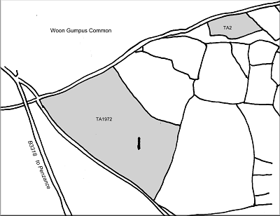
in a croft Long Stone Croft TA(1839) No.1972, marked on OS as Standing Stone.
Boswens
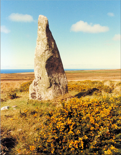 Situated on sloping ground often grazed by cattle, this 2.38 metre (7ft 10in) menhir is clearly visible from the unsurfaced lane below, with Chun Quoit visible near the summit of adjacent high ground topped by an Iron Age hillfort, Chun Castle.
Dr.Borlase recorded the stone in 1754* when it was still surrounded by a low cairn of small stones: “...stands a large stone set on end, ‘tis 3ft broad and 11ft high above the general surface of the ground, a third of which height was formerly buried in a heap of stones thrown round it in manner of a little barrow, but on the west side part of the barrow has been removed, either out of curiosity or more likely out of avarice, common people imagining that nothing was worthy of a work of such labour, but concealed treasure.”
Blight later noted* the stone as being nine feet in height located on Boswens Croft, Sancreed: on another occasion he wrote* that it was on Tregerras Downs and known locally as the Hare Stone – Russell interpreted* this as being a corruption of the Cornish word hyr, meaning long.
W.Borlase (1769) Plate x (opp. page 154)
 By Halliwell’s time hardly any trace of the cairn remained but he thought* that, from the appearance of the ground, it had been about twenty-five feet (7.5m) in diameter.
Copeland Borlase made a watercolour sketch* of the stone on Longstone Downs, Boslow, St.Just – it is actually well within Sancreed Parish – and Charles Moody had earlier referred* to many scattered prospecting pits dug on the slopes of Goon Mein Heere (Long Stone Downs).
Michell described* the stone as being a notable landmark and, although both West Lanyon Quoit and Tregeseal Circle were not quite visible from the stone: “they can be seen from its summit, and this may have been intended, for there are two steps, possibly artificial, on its western edge by which it can be climbed”.
 Lockyear had earlier calculated* that the Men-an-Tol Holed Stone and Boskednan Nine Maidens Circle marked the solsticial sunrise position when seen from the menhir; that Lanyon Quoit was in line with the Pleiades in 1030 BC; and that the alignment with Tregeseal East Circle marked May Day sunrise position. He considered this last alignment to be the most important one from the circle but Barnatt thought* it most likely due to chance since the menhir is hardly visible, although the Victoria County History had earlier stated* that the top of the stone was “just visible over the hedge from the circles”.
SANCREED 2
HIGHER DRIFT
pair of menhirs at (A) 4372/2831 and (B) 4371/2831 in a cultivated field, marked on OS as Standing Stones.
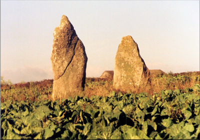 This fine pair of menhirs stand about 4.9 metres (16ft) apart in a north-north-west to south-south-east alignment and are 2.6 metres (8ft 7in) and 2.3 metres (7ft 6in) high respectively.*
 Although now both well within the present boundary hedges, over a century ago the southern stone (A) was then incorporated in the hedge of a field named as Seven Acres in the TA and it is more than fortunate, and not a little surprising, that whoever removed this hedge left the ancient stone in place.
W.Borlase (1769) Plate x (opp. page 154)
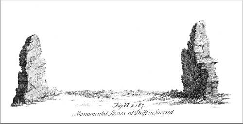 Dr.Borlase recorded the stones in 1754* but made no mention of any hedge – his drawing implies it was not then built – and Blight noted them in 1856.*
Halliwell described the site in 1861:* “The highest (stone) covered in ivy, and in the centre of a hedge, might in the distance be mistaken for the trunk of a tree…”.
Below. Upper: W.C.Borlase (1872): 23
Lower: Cooke 2000 after W.C.Borlase (1871) Excavations and Discoveries
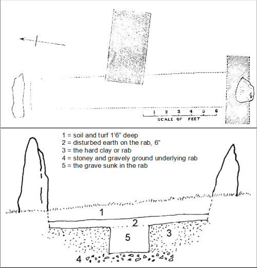 Copeland Borlase excavated between the two stones a few days after his exploration of Pridden Menhir in February 1871 and noted that the tallest stone of the pair was still set in the hedge. He dug a trench between the stones and discovered a cavity “cut with much precision” into the hard natural clay. This ‘grave’ was 1.86 metres long by 0.93 metres wide and 1.55 metres deep (6 x 3 x 5ft), and lay lengthways almost at right angles to the stones: it was filled with previously disturbed ground with a few stones at the bottom, “but no sign of anything worthy of note”.*
Charles Henderson* wrote how the pair of stones were known as The Sisters and his photo shows no stone as being set in a hedge: nothing else is known about these ancient stones that stand only a few yards from the busy A30 main road to Land’s End – passed unnoticed by thousands of people each year.
SANCREED 3
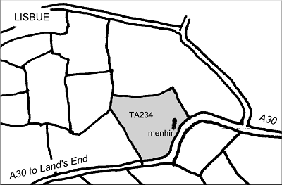
TRENUGGO menhir
at 4253/2818
in a cultivated field Long Stone TA(1839) No.234, marked on OS as The Blind Fiddler Standing Stone.
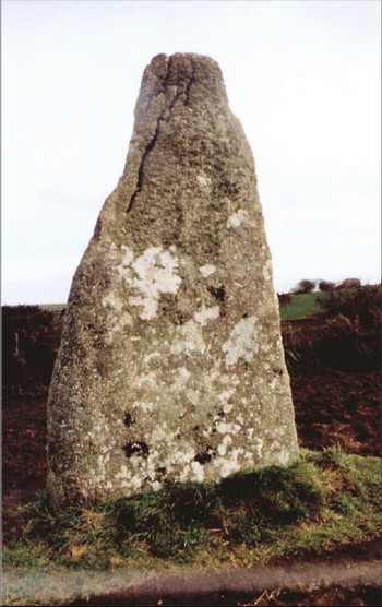 Not a lot is known about this imposing tall thin stone standing 3.55 metres (11ft 9in) above ground level, orientated north south, and studded with quartz. It was not mentioned by Dr.Borlase and Blight appears to be the first to have recorded it.*
Copeland Borlase measured and drew the stone on 7th March 1871,* presumably just after completing his excavation at Trelew Menhir on the same day. He noted that the stone was known locally as The Quoit from the use of the longstone as the mark at which a quoit was thrown.
Lukis (1885) Plate xxx
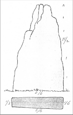 He was informed by a local labourer that someone had once dug by the side of the menhir to see how deep it was embedded and had found it to be four feet (1.2m) below the ground; the same man had found some bits of bone but no pottery.
Similar legends became attached to this stone as for the Pipers and the Merry Maidens Circle and the stone marks the position of midsummer sunrise from Boscawen-un circle* – a time when the sun also illuminates the axe-head carvings on the circle centre stone.*
SANCREED 4
BOSWARTHEN missing menhir
from c.4130/2875
in Long Stone Field TA(1839) No.522, not marked on OS.
St Just
ST.JUST 1
BREA
destroyed menhir formerly at 3812/2798 in a field Park Skeber (i.e. Barn Field) TA(1843) No.3828, still marked on the 1995 OS map as Standing Stone.
Brea. Reproduced courtesy of John Michell
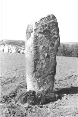 Blight first recorded* this menhir in 1856 as being seven feet (2.1m) high in Breu, St.Just, but, since there is no place of that name in the parish, it is often suggested* that Blight was referring to a now lost stone at Brew in neighbouring Sennen Parish. However a rough note made by Blight* on corrections to be made to his first volume of ancient crosses lists Brey to replace Brew, St.Just (yet further different spellings!), so it seems certain that his intended reference was to this stone below Chapel Carn Brea in St.Just Parish.
Charles Henderson must have looked for the stone in Sennen and St.Just but, after a look around Brea, he wrote* that “there is no menhir there either”. Michell noted* that there were then several other smaller ancient looking stones in the vicinity of the menhir and recorded several good alignments. The site was scheduled in 1972* following information of a threat to the stone due to intended large-scale clearance of surrounding croft land for arable farming. However, although now a legally protected monument, this was no guarantee to its preservation.
In 1985 the ancient menhir was deliberately uprooted and broken up.* I was informed during 1988 that the person responsible, who had removed several nearby hedges, smashed the menhir into three pieces to prevent its re-erection; apparently he was ordered to pin the pieces together with metal rods and put it back – he died before this could be done.*
Privacy: we're not interested in your private data. This site collects stats to observe traffic in general only. we're not into capturing data, giving or selling your data to others or making mailing lists. Any problems, contact the webmaster. Enjoy your visit! | Website built with love by Palden Jenkins in West Penwith, Cornwall