The Backbone Alignments of Belerion
Backbone Alignments
Backbone alignments form an integrated system covering West Penwith. In a way Penwith is one big ancient site or cliff sanctuary. They also govern the location of key ancient sites such as the stone circles. The backbone alignments go back to around 3700 BCE in the Neolithic period.
What are backbone alignments?
These alignments involve smaller numbers of sites, but the sites they connect are very important ones. Backbones form the main 'circuitry' of Penwith.
Generally they pass through at least three major sites, with at least 1-3 of them being significant natural features such as Neolithic tors or cliff sanctuaries. They are strongly involved with defining the siting of Penwith's stone circles.
Backbone alignments map
Click on the map below to see it in more detail on Google Maps
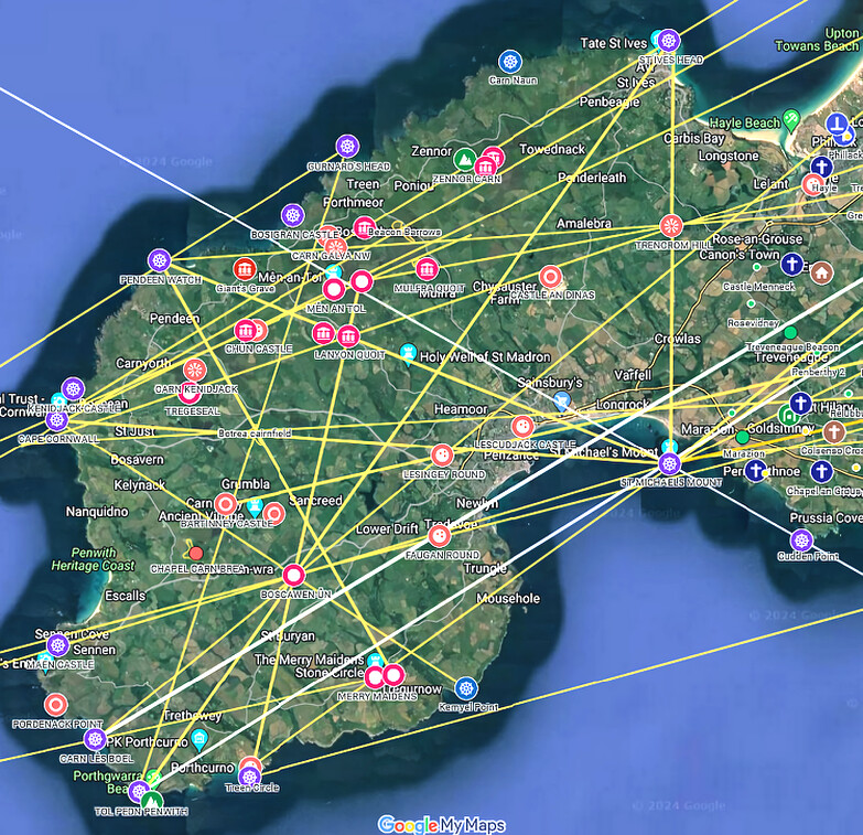



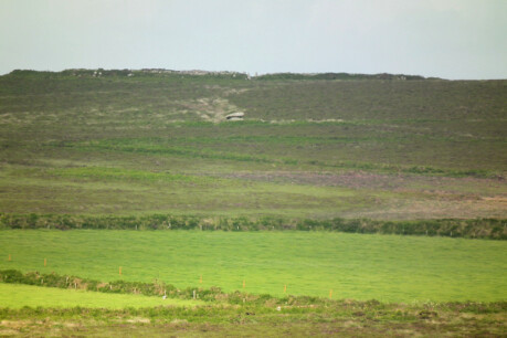
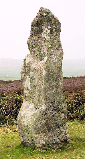
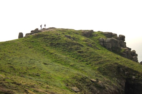
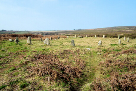
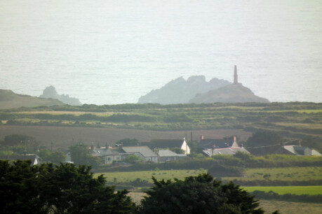
Key backbone nodal sites in Penwith are Lanyon Quoit, St Michael's Mount, Boscawen-ûn, Treryn Dinas, Cape Cornwall and Botrea Barrows.
Backbone alignments are analogous to high-tension power cables on the national grid, operating at a high voltage to reduce energy-loss over long distances. This power is then transformed to lower voltages to enter local networks.
Except alignments do not transmit energy: instead, aligning sites helps them operate with the same or similar programming.
Backbone alignments act as a primary alignment system in Penwith - a matrix upon which the complete system works. Major sites act as transformers, redistributing to lesser sites.
An alignment must have two Neolithic tors or cliff sanctuaries on it to qualify as a backbone alignment. Often they have other significant sites on them as well, but it is the two kinds of Neolithic sites that define the alignment.
How they were discovered
The discovery of backbone alignments happened on a hunch. I examined St Michael's Mount to see whether there was an alignment to Cape Cornwall - since both are similar as conical hills in a marine setting. Indeed there was an alignment: it happened to pass through the Bronze Age Botrea Barrows on the hill just above my home!
This was a surprise. The alignment gave these barrows on Botrea Hill a new significance. This was something of a eureka moment.

Then I started seeking similar alignments and, before long, a number were found radiating from St Michael's Mount. Three in particular were clearly powerful ones:
- alignment 108 went from Carn Brea near Redruth (a Neolithic tor enclosure), through St Michael's Mount (a tor enclosure), then through the Merry Maidens stone circle, and ending at Treryn Dinas, a spectacular cliff sanctuary near Porthcurno. That's three natural Neolithic sites and one stone circle, all aligned;
- alignment 59 went from St Michael's Mount through Trencrom Hill (a Neolithic tor) to St Ives' Head (a cliff sanctuary) - two cliff sanctuaries and one tor enclosure;
- alignment 78 went from St Michael's Mount to Ennis Farm menhir and Boscawen-ûn stone circle, proceeding to Maen Castle, a cliff sanctuary, then to the offshore Longships rocks. Then it proceeded to Chapel Downs cairnfield on St Martin's in the Scillies, finishing at South Hill, Bryher, a noteworthy site akin to a cliff sanctuary. This alignment comprises two cliff sanctuaries, one stone circle, a cairnfield and a prominent hill.
Something was going on. This led to a more systematic examination of prominent hills and headlands. Certain sites usually not recognised as cliff sanctuaries indeed turn out to be so - such as Cape Cornwall, Pendeen Watch, Tol-Pedn-Penwith and St Ives' Head. This is verified by the magnitude and pattern of backbone alignments passing through them. Click here for a cliff sanctuary map.

The siting of key ancient sites
The major megalithic sites of Penwith are located where they are by using this framework of alignments. This was a significant discovery.
Alignment 80 starts at Carn Brea, passing through an Iron Age enclosure at The Hood in East Penwith before hitting Trencrom Hill. Then it passes through Lanyon Quoit and Boswens menhir before intersecting the Botallack Common cairn in the Tregeseal complex, and finally ending at the Brisons, the offshore rocks off Cape Cornwall. This alignment was clearly a key factor in placing the Tregeseal complex where it is.
Alignment 103 passes through only three sites. But look at the three sites it connects: St Michael's Mount, Lanyon Quoit and Pendeen Watch (a cliff sanctuary).
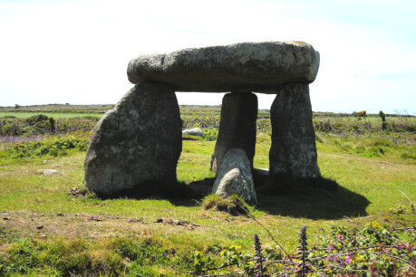
Here we come to Lanyon Quoit and its key positioning. It lies at the intersection of alignments 80 and 103. There's more.
Look at alignment 37: it starts at Treryn Dinas cliff sanctuary, passing through Boscawen-ûn, Goldherring 2 Barrow, Newham Farm menhir, then Lanyon Quoit, then Bosiliack Barrow (a chambered cairn), finally ending at the Nine Maidens NW menhir (in the Nine Maidens stone circle complex).
 Lanyon Quoit is located at the intersection of alignments 103, 80 and 37, and that's why it's there. It was built around 3700 BCE, which implies that these alignments must be the same age or older. It also implies that the cliff sanctuaries are of a similar antiquity.
Major alignments such as the backbones don't always go straight to stone circles. Sometimes they go to outlying menhirs or cairns that are part of a stone circle complex - as with alignments 37 and 80 above. A stone circle complex is important as a whole - the stone circle should not be considered in isolation.
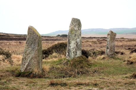
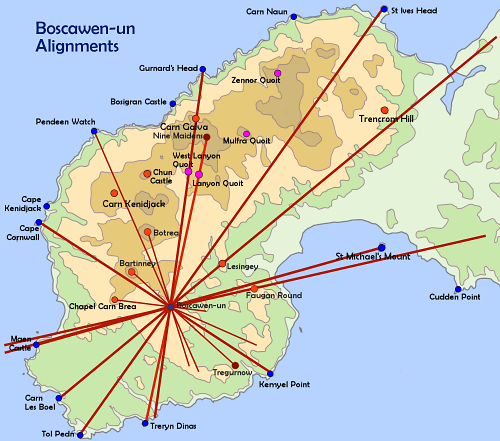 Boscawen-ûn is placed at the intersection of five alignments: 97 and 78 (both going to the Scillies) and 79, 93 and 37.
 They all connect with cliff sanctuaries in Penwith. Take a look at the backbones map to see its nodal centrality in the backbone system.
Cape Cornwall has at least five backbone alignments going to or through it. Trencrom Hill is visited by four. Botrea Barrows act as a node for four backbones.
Implications
First, an overarching locational system for the whole of Penwith exists. Thus, no ancient site in Penwith can be considered in isolation - it is part of a complete system.
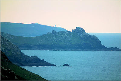
Gurnard's Head with Pendeen Watch behind
 Second: cliff sanctuaries. These are regarded as Iron Age, dating from around 300 BCE to CE 100. But the backbone system is staked out on the cliff sanctuaries and the Neolithic tor enclosures - so cliff sanctuaries are shown to be Neolithic in origin.
Most of the archaeological remains at cliff sanctuaries indeed were built in the Iron Age, though at that time they recycled clifftop sites used in the Neolithic. This is also the case on inland hills such as Chûn Castle and Trencrom Hill - both Iron Age 'hillforts' sitting on Neolithic remains.
Cliff sanctuaries thus prove to be more important than previously understood. They act as major bordering nodes on the coastal periphery of the Penwith system. Key to this is St Michael's Mount, the 'transformer' for the peninsula.
The backbones link prominent natural features that were important from the very beginning of the megalithic period in the Neolithic, around 3700 BCE. They also link the stone circles, which go back to the Bronze Age around 2200 BCE. Before that, they might well have been recognised as sites since around 3700 - because they are so intimately involved with the backbone alignments.
Third: dating. The basis of the backbone system must have been established around the mid-Neolithic, around 3700 BCE. The major clue is Lanyon Quoit, built then, the location of which is defined by three backbone alignments passing through it. The Neolithic tor enclosures, also built around 3700, back up this dating.
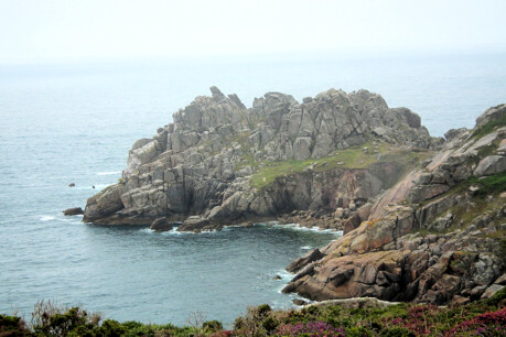
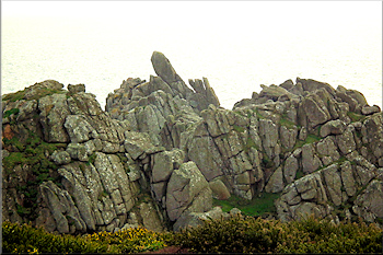
Treryn Dinas cliff sanctuary
Fourth: topography. A relationship between topography - hills and headlands - and the spatial distribution of ancient sites in Penwith is now established. This has not been clearly demonstrated before in Penwith.
Fifth: the chicken possibly did come before the egg. There is a debate amongst dowsers and geomancers about earth energies: it has been found that earth energies can respond to the building of sacred sites by moving small distances toward a sacred site when it is built. However, a distinction should be made here between base sites - mostly natural, such as hilltops, carns and headlands - and secondary, man-made sites - such as menhirs and cairns. In the case of man-made sites, the question arises, were ancient sites built because energy was already there, or was energy generated by the building of the sites? The answer is probably a mixture of both, and this needs further research.
The backbone system, anchored to natural features, suggests that energy was there before humans came along, and that the people of the Neolithic identified it and did something with it. They used the cliff sanctuaries and tor hills as nodes in a grid that gives structure to the complete array of megalithic sites in West Penwith.
Thus, the evidence swings in the direction of already-existing energy fields, connected with prominent natural features.
Conclusion
The discovery of backbone alignments demonstrates that the builders of the ancient sites of Penwith had a grand plan.
It probably wasn't a preconceived plan, yet they certainly followed a consistent logic, as ancient sites were built and the system we see today took shape over a period of centuries.
The backbone system gives the ancient sites of Penwith a new coherence, suggesting that the system as a whole operates as a wholeness. There's more to research here.
Privacy. This site uses temporary cookies to watch general trends only. We aren't selling anything, capturing, mining, passing on your data or making mailing lists. It's a public service - no strings. Any issues, please make contact.